Lake Fact Sheets and Health Scales
Lake fact sheets are a great way to take a tour of the watershed. Each fact sheet reflects a variety of studies and monitoring that helps tell the story of the lake. To get to know a lake, we look to the lake's data such as chloride and nutrient levels, the fish population, aquatic and shoreline vegetation, and other issues that may be occurring in the sub-watershed area. A sub-watershed can be a catchment area for a specific lake, or a grouping of several lakes that share a drainage connection.
Each fact sheet is equipped with quick facts such as lake depth, common fish, and the lake's sub-catchment area. Most sheets also include a lake data graph, a nutrient chart, and whether or not the lake meets MN State standards for nutrient levels. To dig deeper and learn more, visit our waterbodies page to find each lake's specific web page. VLAWMO monitoring staff are continually updating these pages with new data and studies as they're made available. For more detailed information on VLAWMO water quality, find our annual water monitoring reports on our reports web page.
2020 Lake Fact Sheets:
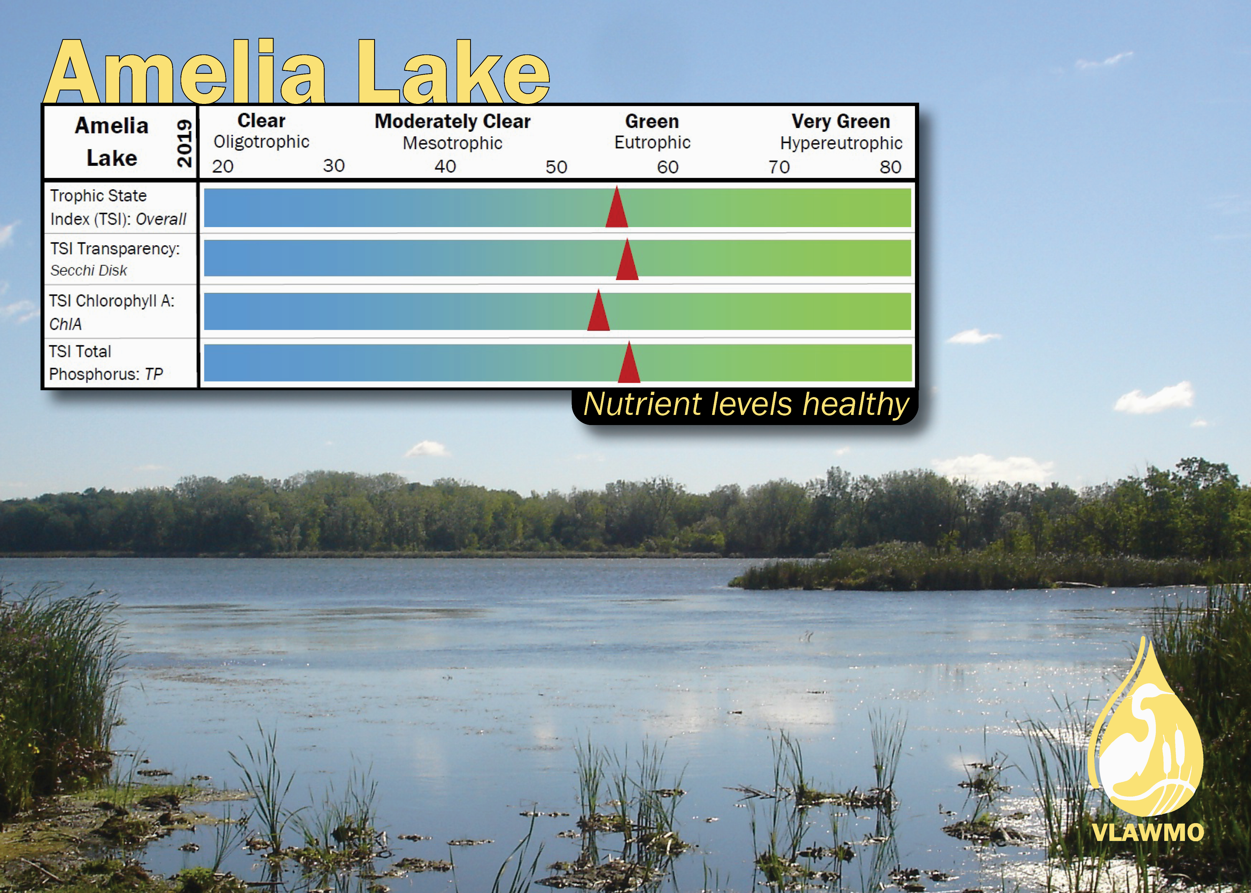
Amelia
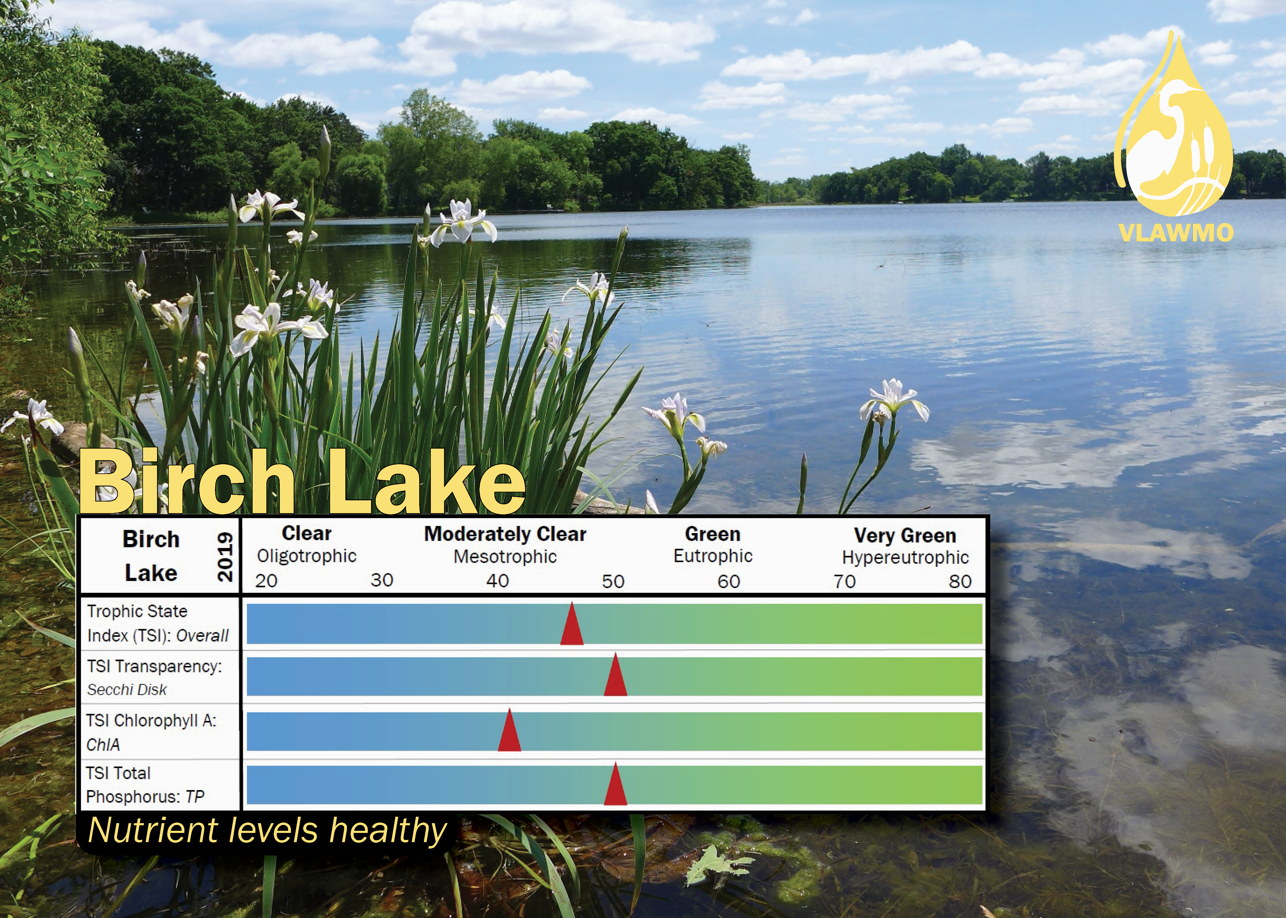
Birch
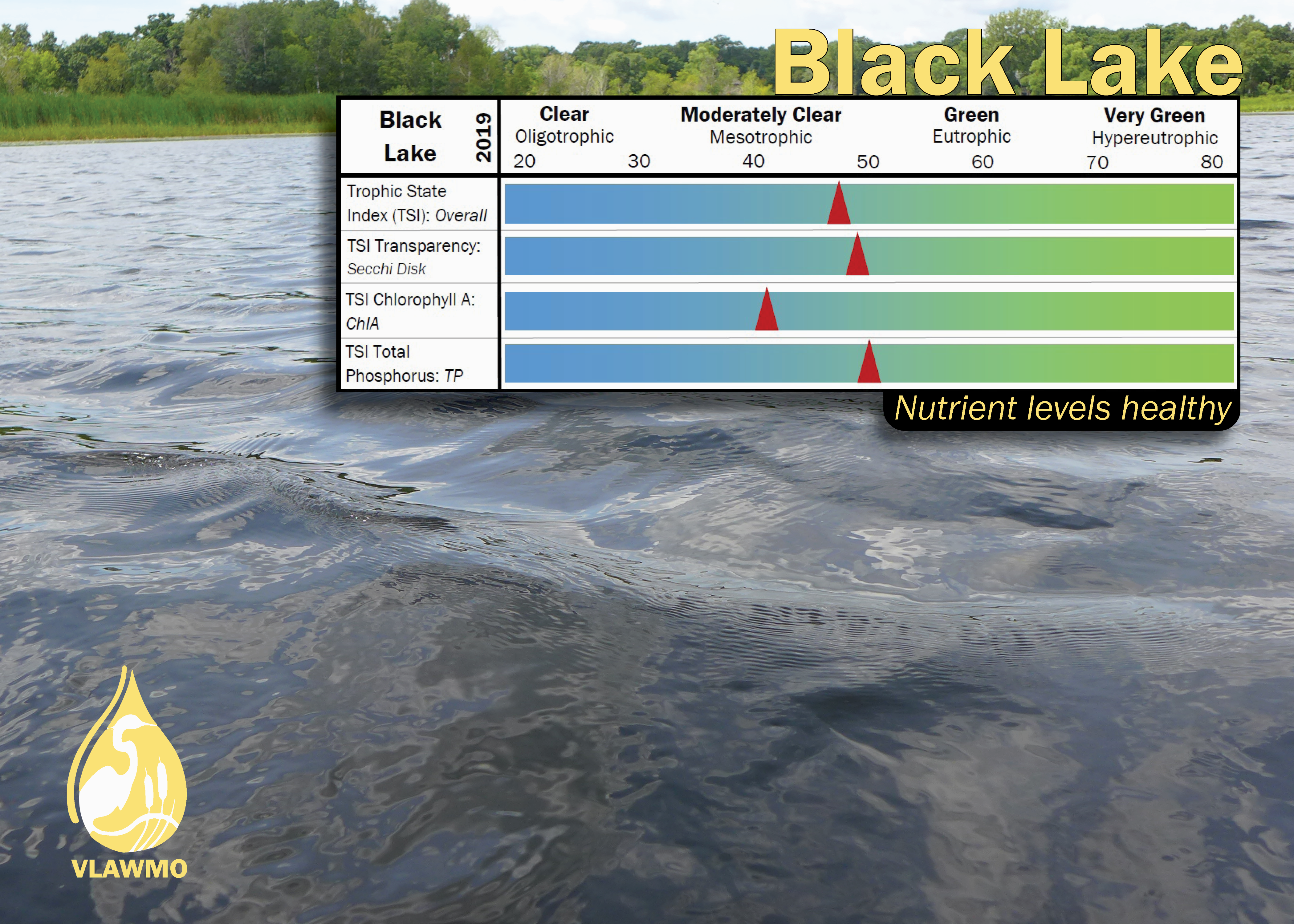
Black
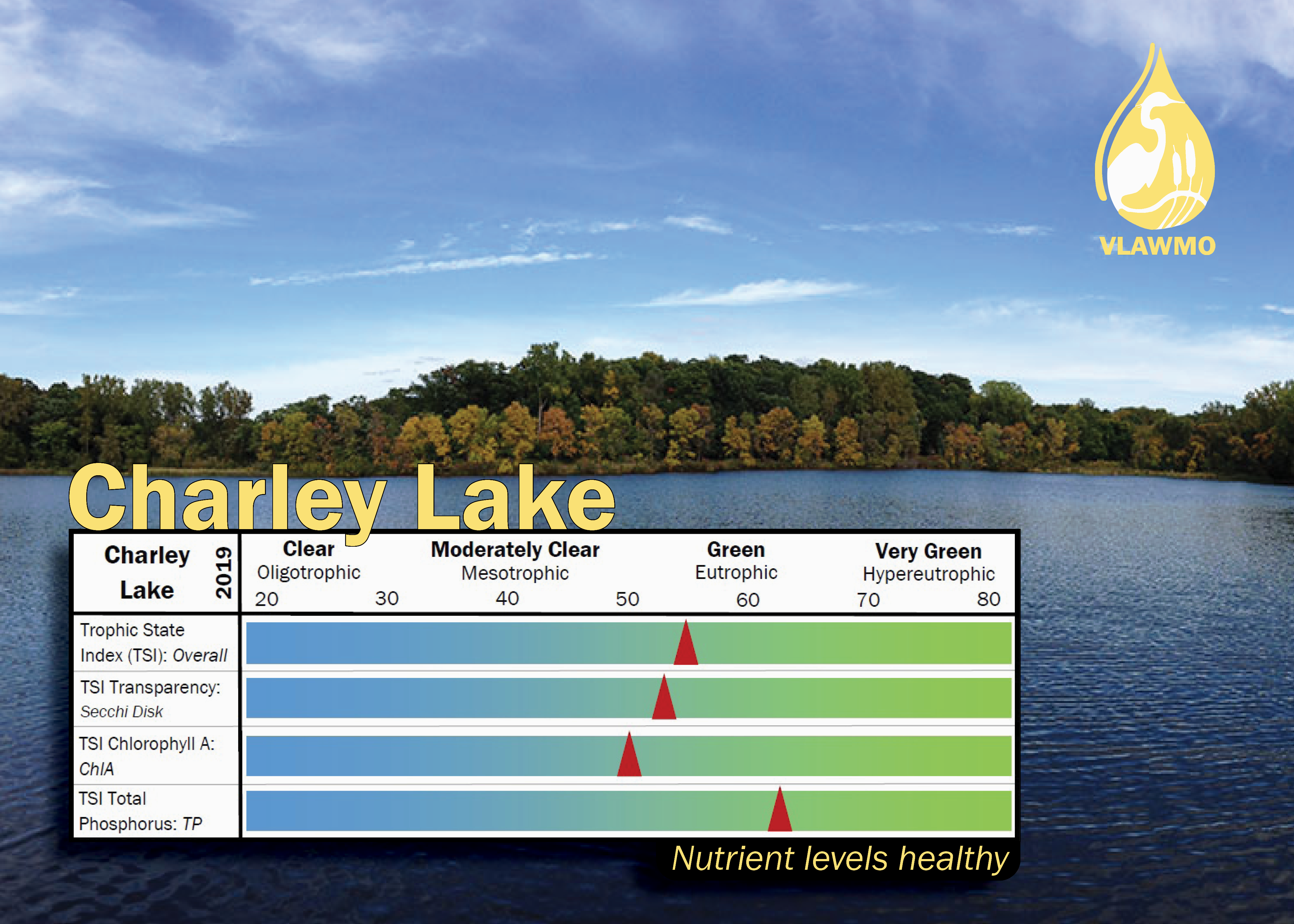
Charley
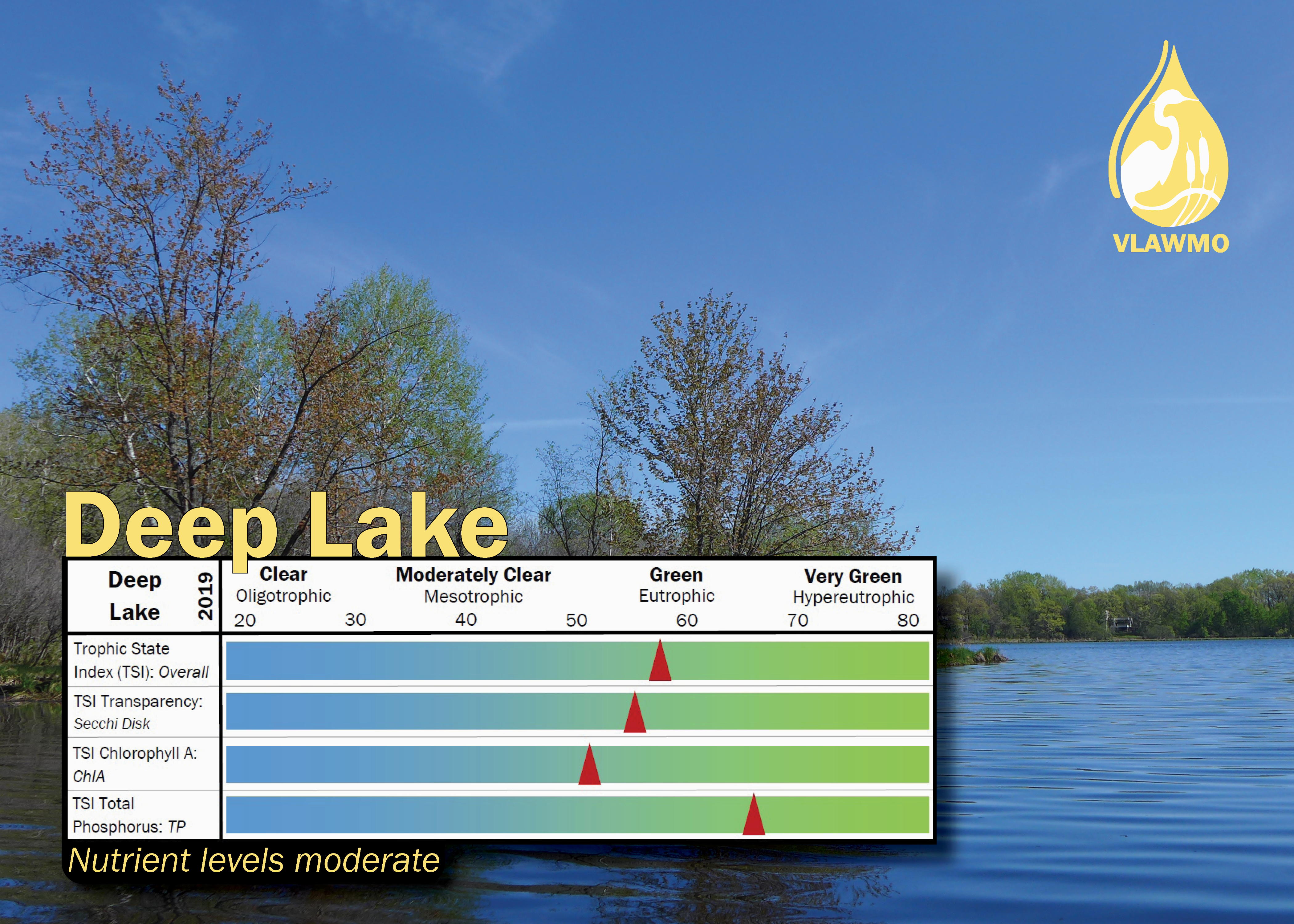
Deep
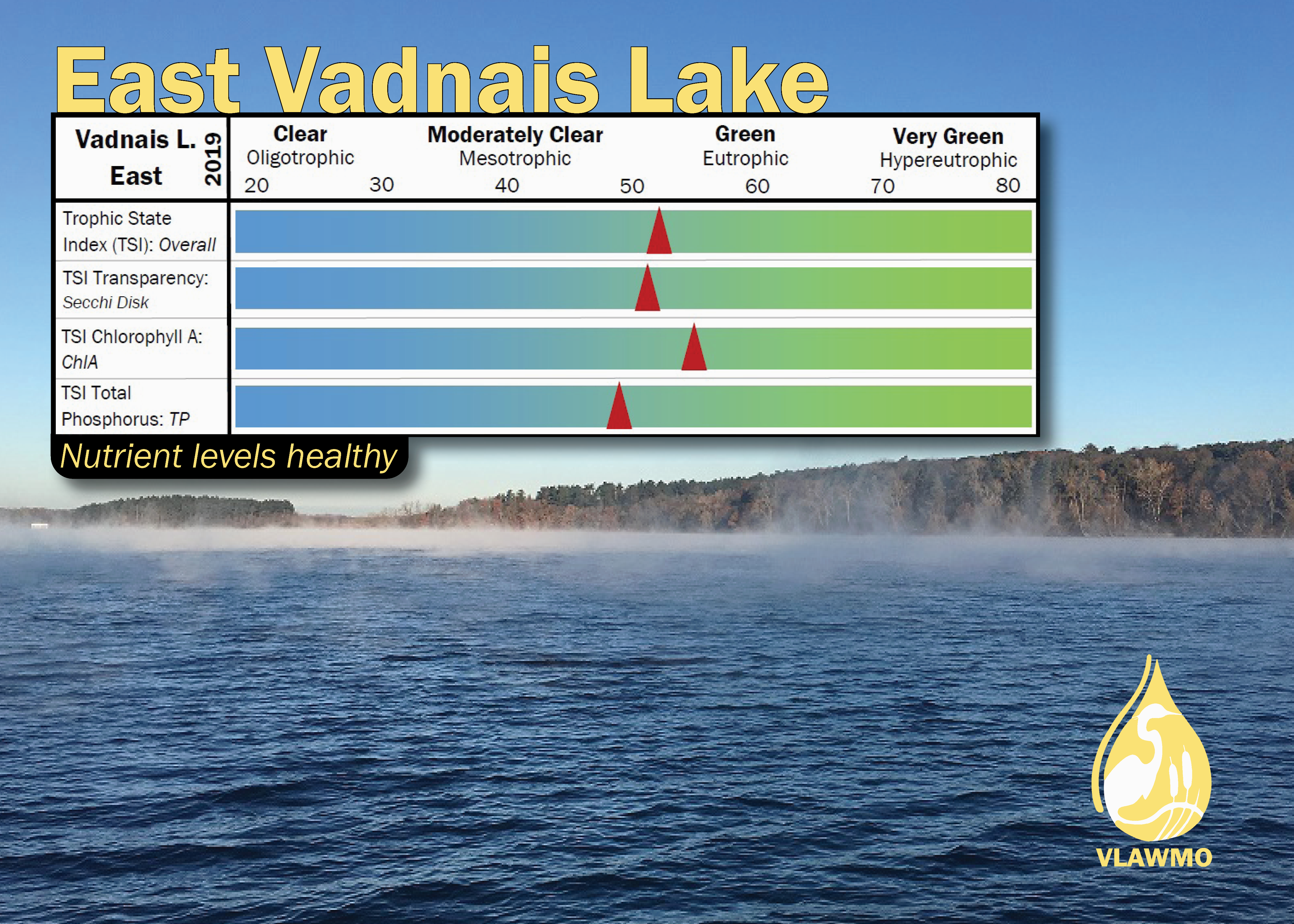
East Vadnais
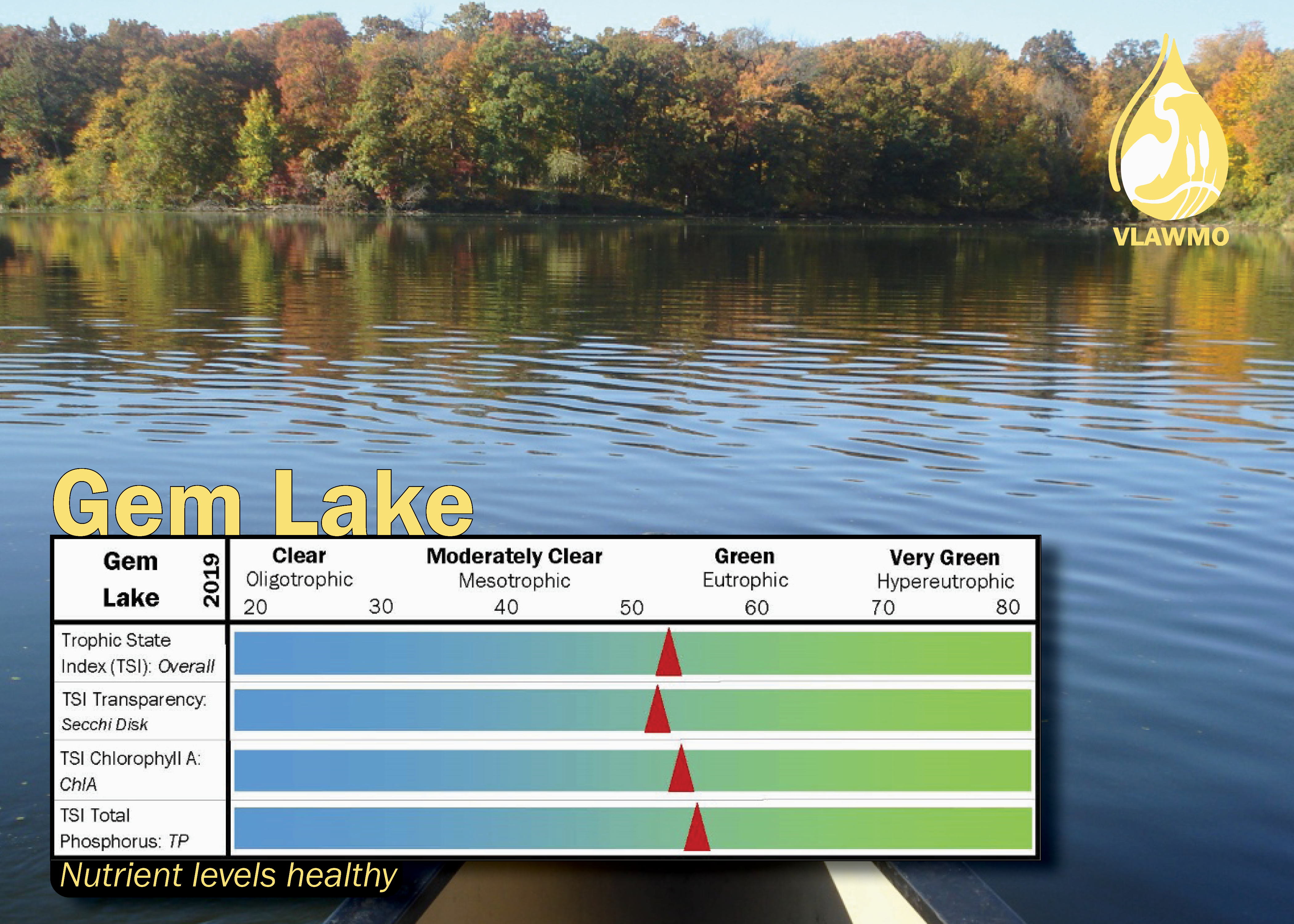
Gem
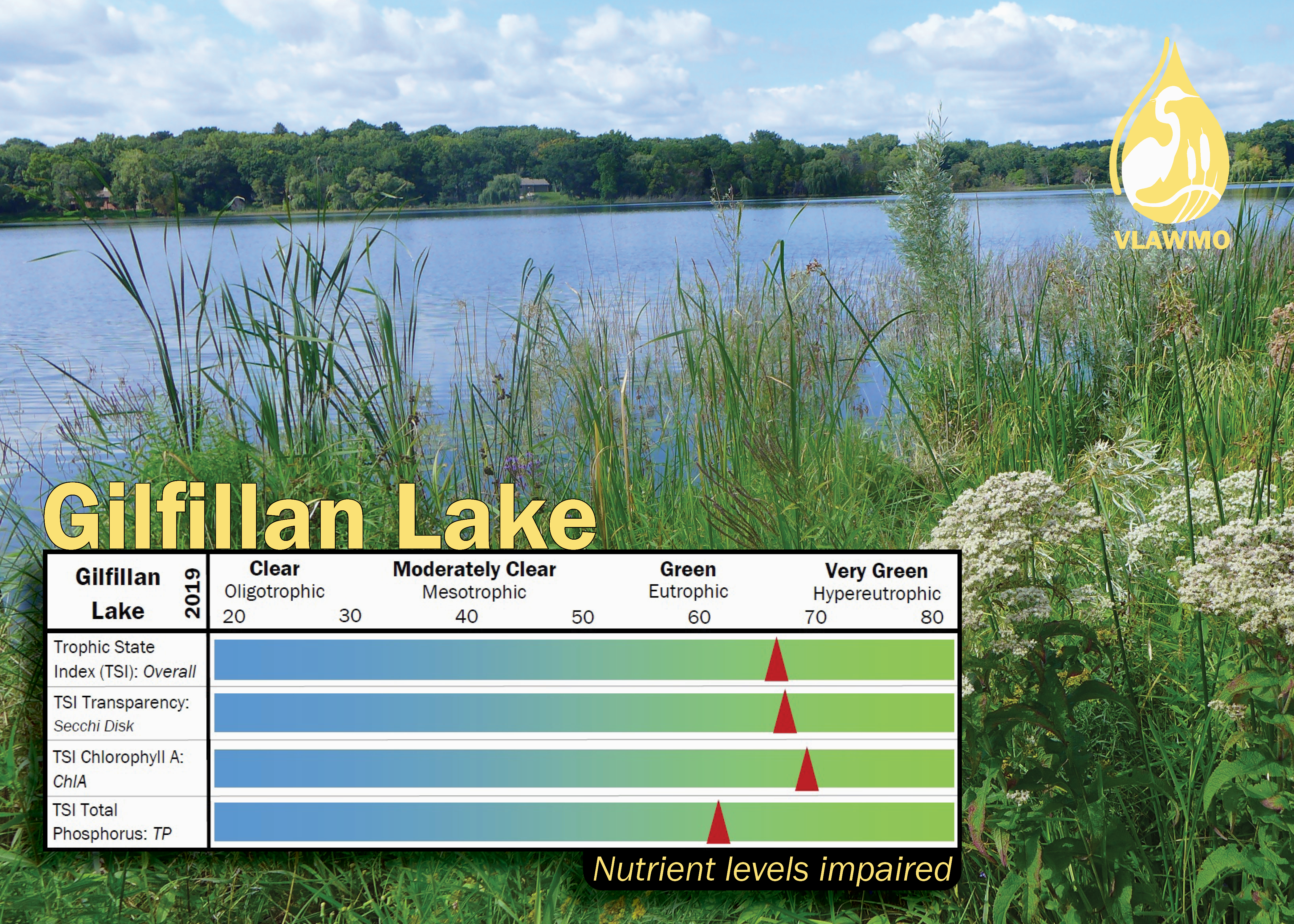
Gilfillan
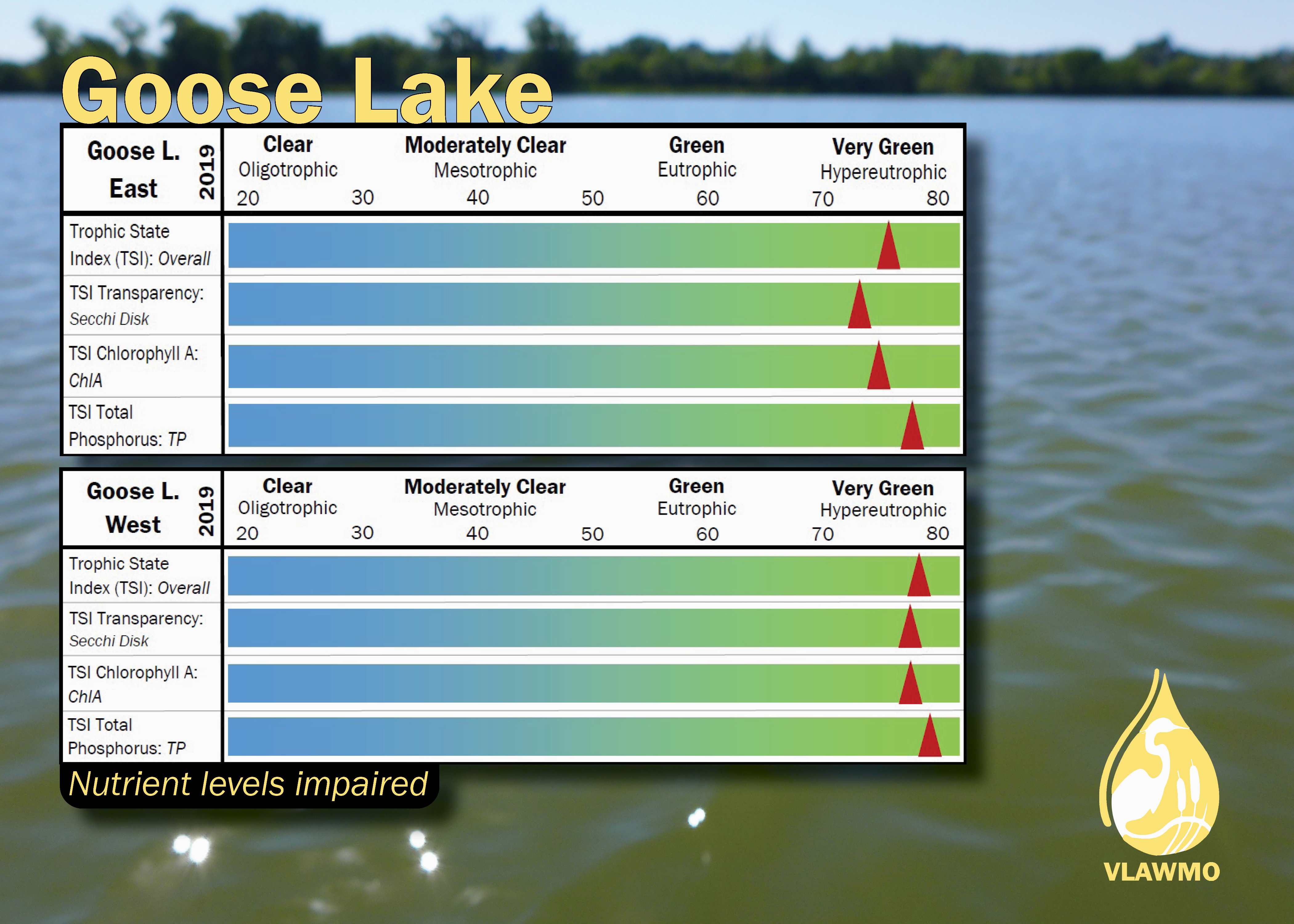
Goose
Lambert Creek
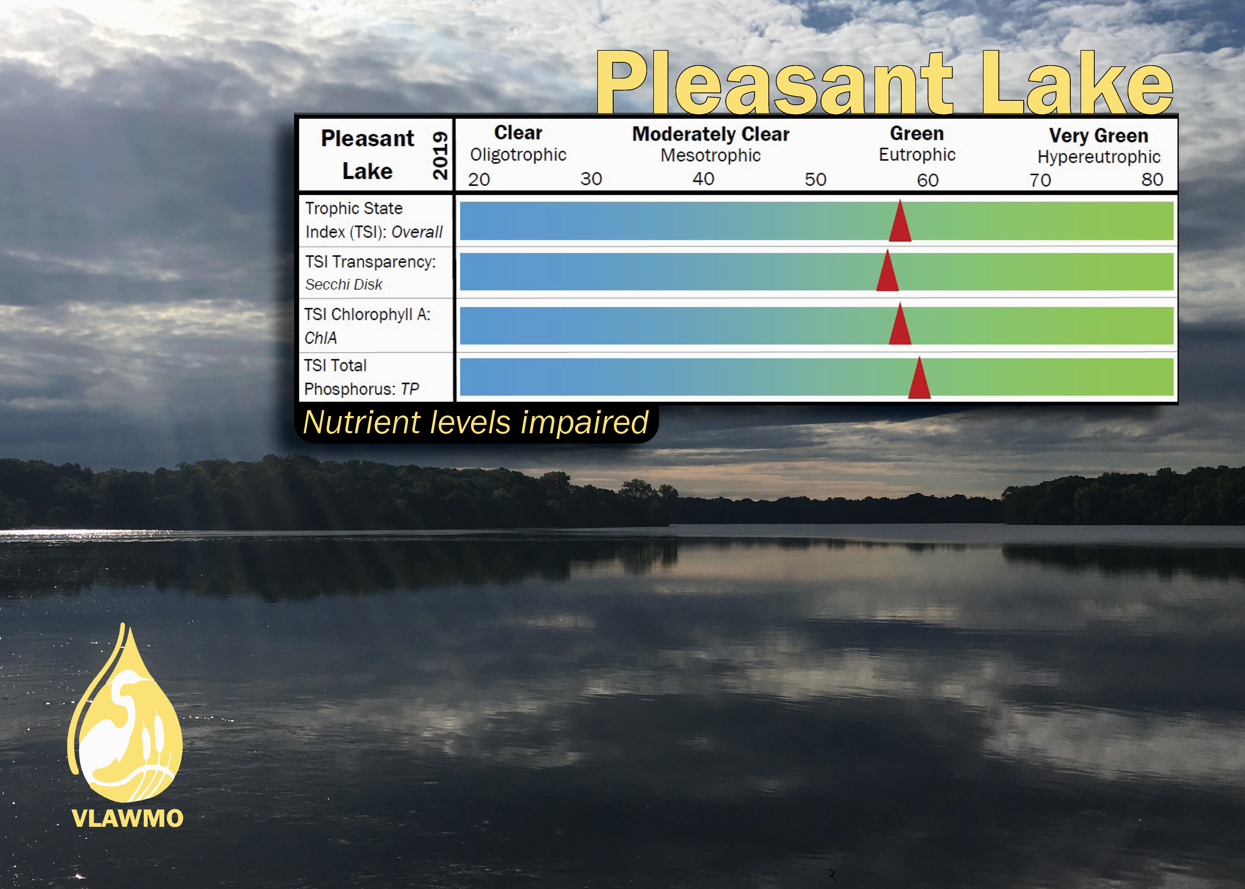
Pleasant
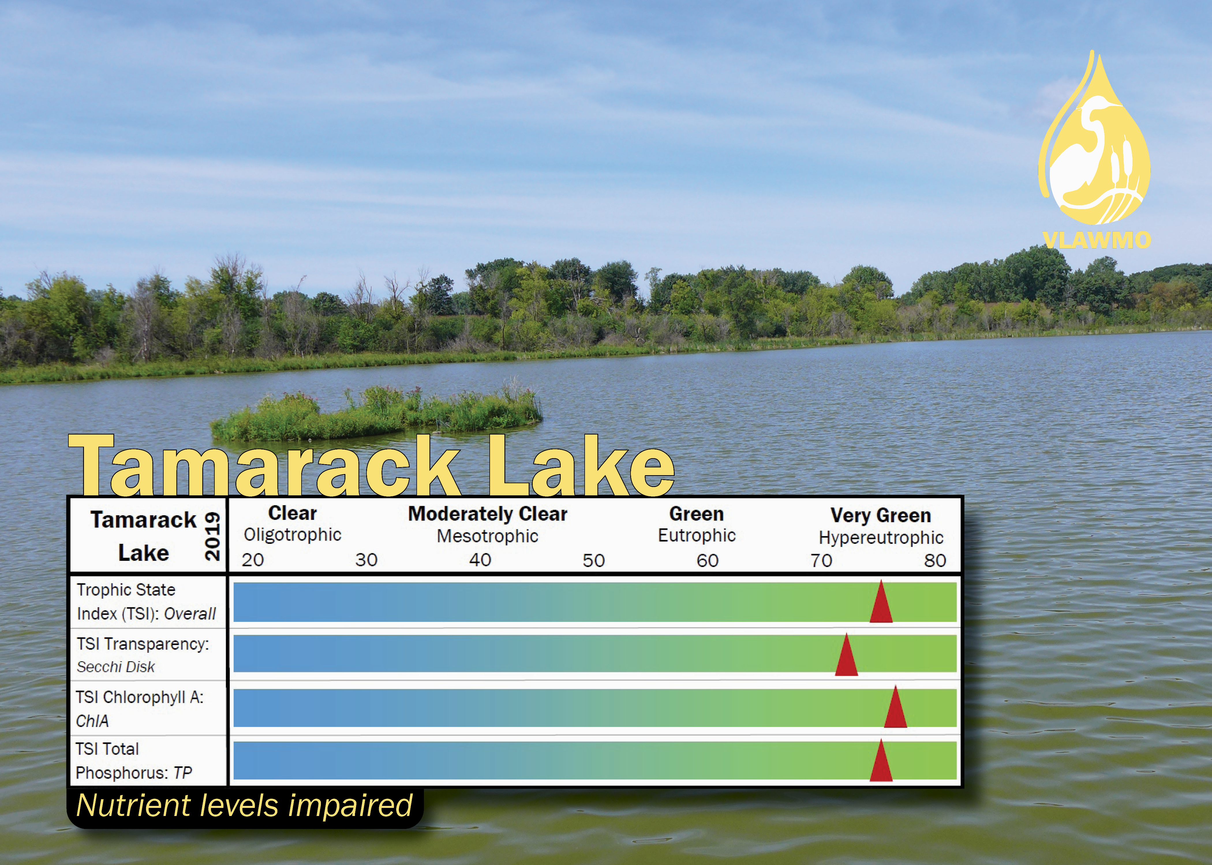
Tamarack
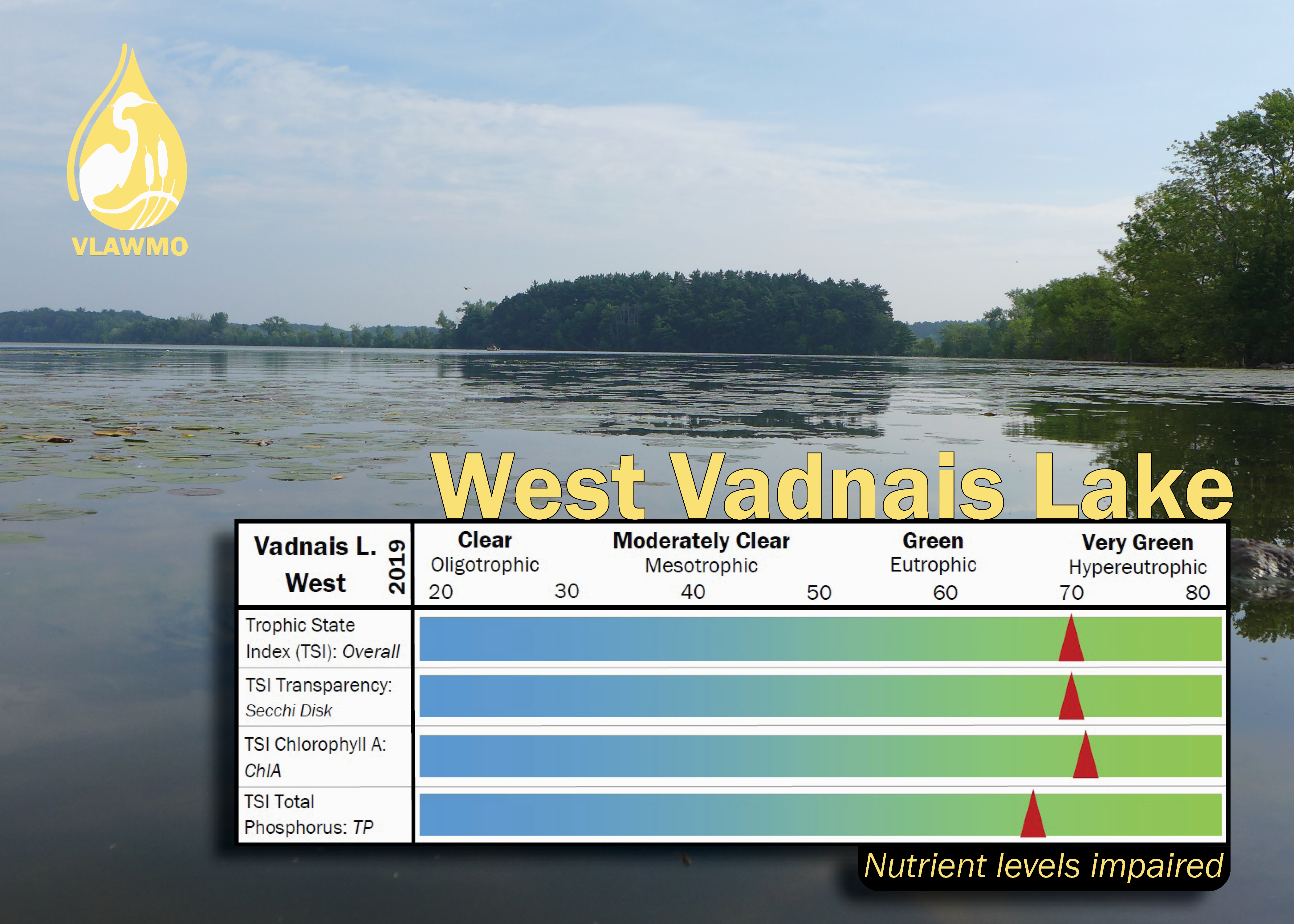
West Vadnais
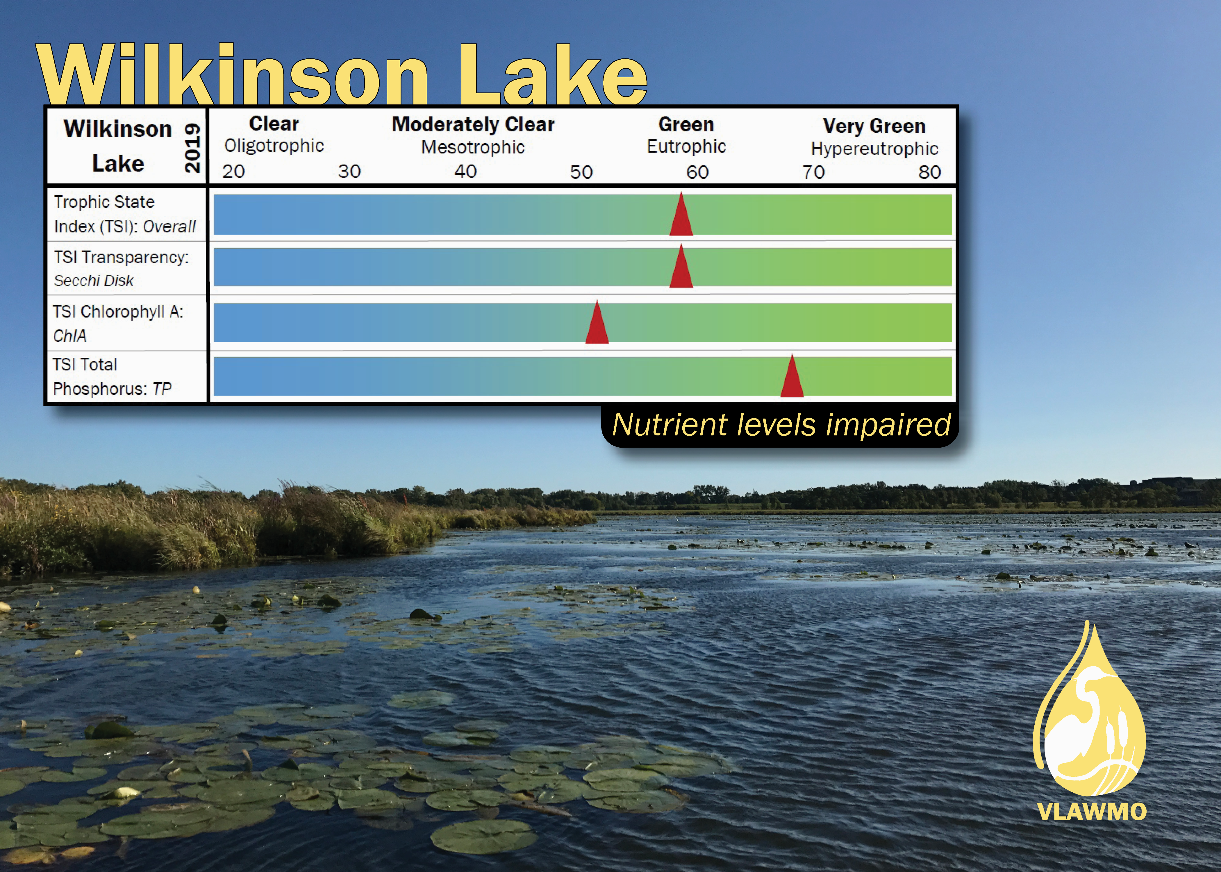
Wilkinson
Lake Health: Trophic State Indices (TSI)
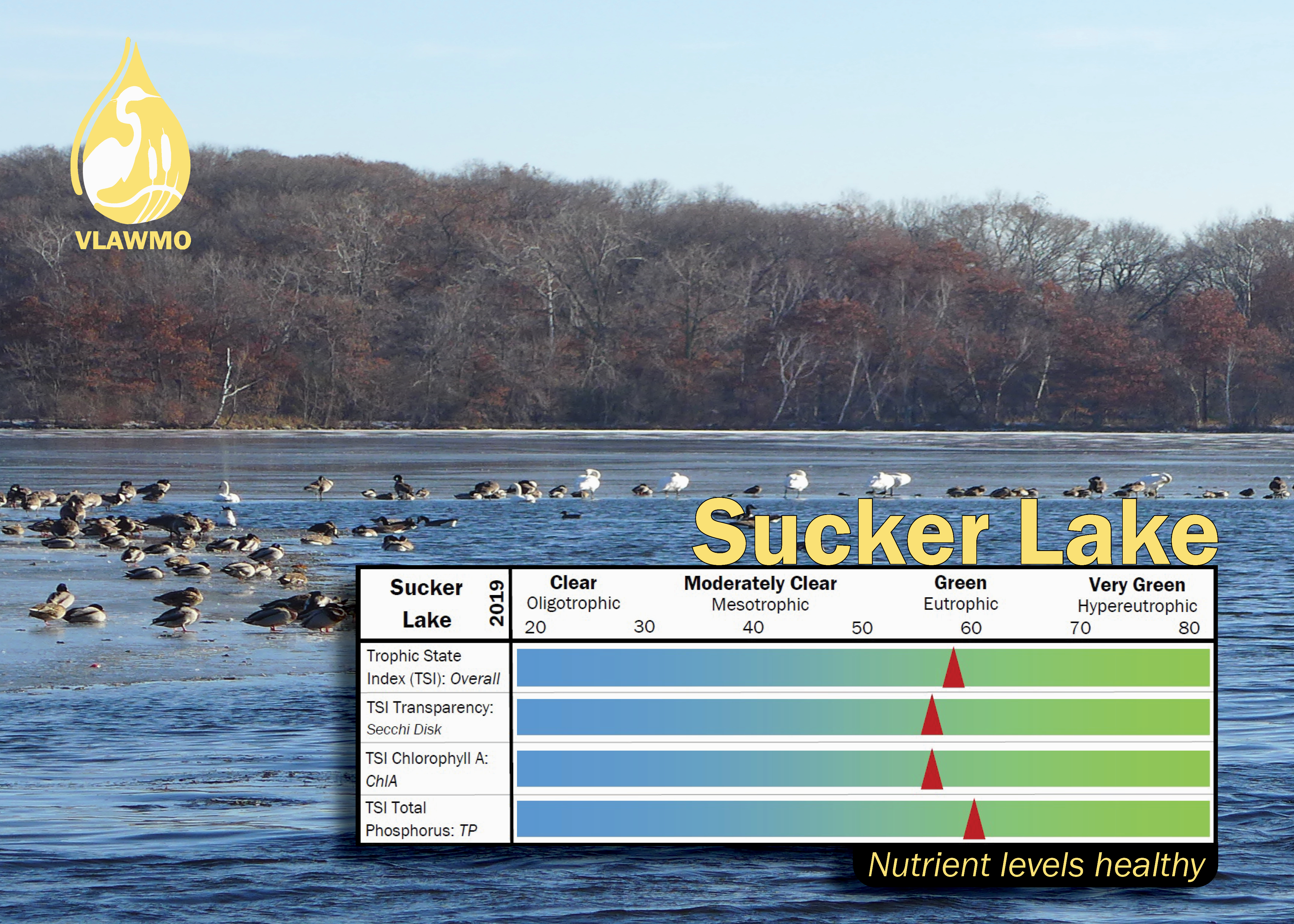
The Trophic State Index is tool used to measure and compare lake nutrient levels on a scale of 1-100. To do this, we look at transparency (measured by Secchi disk), chlorophyll, and phosphorus levels. In addition to the index values for individual lakes, organizations like VLAWMO also look to the Minnesota ecoregions. Lakes in the same ecoregion are classified together to generally accommodate for shared habitat, natural history, soil, and hydrology. For example, lakes in Northern Minnesota (Northern Lakes and Forests) have different hydrology, groundwater, and soil features than lakes in the Twin Cities metro (Northern Central Hardwood Forest). Northern lakes are also generally deeper than the dominant shallow lakes seen in the Twin Cities. Find a map of Minnesota ecoregions below to see the region boundaries. These contrasts between region and lake depth guide MN State standards for listing lakes on the State impaired waters list. VLAWMO uses annual water quality data to calculate TSI ratings and lake impairments for its major lakes, pictured here.
Visit these links for more information on lake classification and TSI ratings:
- Map of Minnesota Ecoregions
- Nutrients and Water Quality: MPCA
- Carlson's TSI Classification
- Annual Water Monitoring Reports
Recent Posts
Neighborhood Spotlight: Carol
Neighborhood Spotlight: Joe
VLAWMO Recruiting MN Water Stewards
Neighborhood Spotlight: Ingrid
Spring Yard Care for Water Conservation
More news
 Contact us
Phone: (651) 204-6070
Fax: (651) 204-6173
Email: office@vlawmo.org