Little actions make a big difference for our waters.
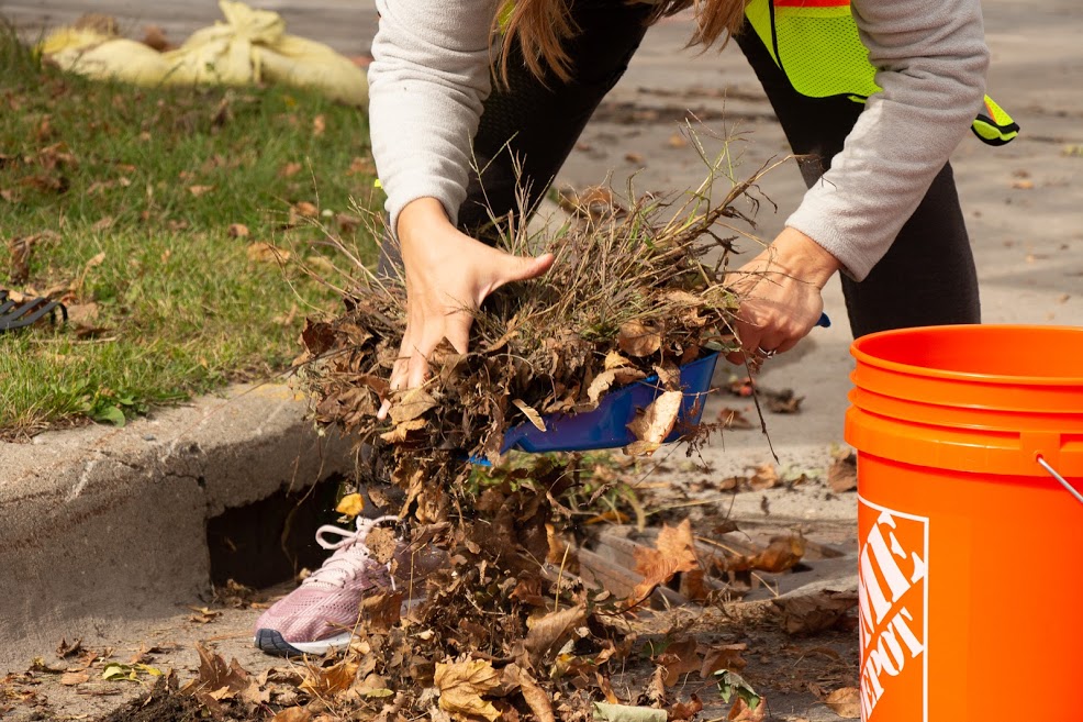
Keep curbs and storm drains clean.
Did you know that rainwater (or stormwater runoff) from streets carries anything in its path to local waters? Storm drains send water and pollution directly to our lakes, streams, and wetlands.
To prevent water pollution, keep leaves, grass clippings, trash, and other debris away from streets and gutters. Grass clippings left on the street can create harmful algal blooms, but blown into the yard, they make free fertilizer. You can mulch or compost leaves to reduce the debris that joins local waterways. In the winter, sweep up excess salt or sand for reuse.
Want to join others who have made quick cleanups a part of their routine? Over 280 storm drains have been adopted in our watershed alone! Visit adopt-a-drain.org to join the movement. With only 15 minutes a couple times a month, you can take big strides toward reducing water pollution!
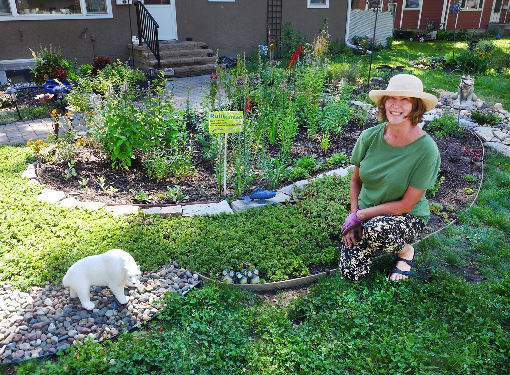
Choose water-friendly landscaping.
Choices made on land have tangible impacts on the health of waterbodies. Reimagining outdoor spaces can beautify our communities and protect water.
- Use more native plants.
- Install a rain garden.
- Get a rain barrel.
- Try an alternative yard.
If you live in the VLAWMO watershed, you are eligible for grant funding to support these practices. Check out our grants page to learn more, visit our library for more background on these practices, or check out this short video for inspiration,.
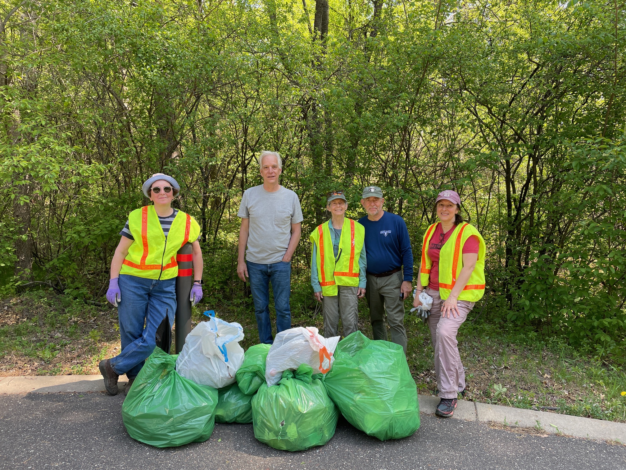
Volunteer.
They say that many hands make the work light, and when it comes to water, this couldn't be more true. Whether you make a difference on your own time or join a group event, we appreciate your efforts to be a good steward of our watershed.
Learn more about the service opportunities VLAWMO offers on our main volunteer page. Do you want to be added to our volunteer email list for the latest information on opportunities? Contact Angela Hugunin, Communication & Outreach Coordinator.
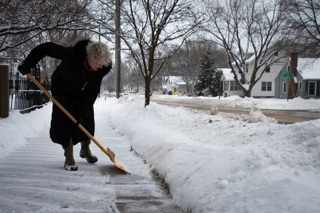
Use Smart Salting practices.
It only takes one teaspoon of salt to permanently pollute five gallons of water. Salting in a smarter way boosts safety, saves money, and protects our water.
Physical removal of snow and ice is the most important tool we have when facing winter snow and ice. Start early when possible to help prevent snow and ice from compacting. The more snow and ice can be removed manually, the less salt is needed. Physical removal also boosts the effectiveness of the de-icing product that is applied.
A variety of tools can support a variety of winter weather conditions. Any of the following tools can serve snow and ice removal, depending on conditions:
- Brooms
- Scoop shovels
- Flat landscaping scoop shovels
- Push shovels
- Ice chisels
- Ice scrapers
Using the right de-icing product for the conditions is key. Certain types of salt are more effective than others in colder temperatures. Typical rock salt is not effective below 15 degrees Fahrenheit. Magnesium chloride, potassium acetate, and calcium chloride are more effect de-icers at lower temperatures. On below-zero days, sand is the best option for creating traction.
Brines are another option for applying salt strategically. These solutions are applied before a winter storm event to prevent ice from bonding to pavement.
With any product, responsible use is key. The substances used for de-icing contain nutrients and/or pollutants that can reach waterbodies and contribute to pollution. Be sure to store any excess de-icer responsibly - always with a closed container. Dispose of any leftovers in a household drain, never on pavement.
If you must apply a de-icing product, remember that it likely takes less than you think to make an impact. When using rock salt, ensure no crystals are overlapping. Avoid clumps of salt to reduce the damage of corrosion.
Never apply dry de-icing products to bare pavement. This leaves the product at risk of being displaced, potentially polluting a local waterbody while leaving the surface unprotected.
Err on the side of using less product so you can observe how it functions. Re-apply if necessary.
After the weather event, sweep up extra salt, sand or grit. If it's dry, excess salt can be stored in a sealed container for later use. Sand that has been driven over may have lost its traction and should be thrown away.
Use only what you need.
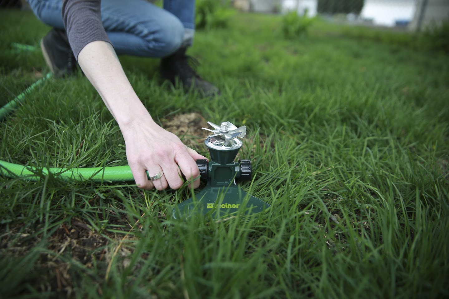
Adjust your watering based on weather and remember to scale back after rain. To get the most out of your watering, make sure you're not sending water to pavement when you irrigate. Keep sprinkler height low when possible to reduce wind interference. Water in the morning to reduce evaporation.
University of Minnesota Extension shares that traditional turf grass may only need about a half-inch of water per week - a lot less than what we often think. Less frequent watering encourages root growth and drought tolerance.
Keeping lawn height in the three- to five-inch range encourages your turf grass to develop deeper roots. In addition to saving you time on watering and mowing, longer roots keep your lawn viable in dry months or drought periods.
Turf types such as fine fescues are designed to require minimal water, fertilizer, and mowing. Bee lawns are another low-maintenance option with the added benefit of supporting at-risk pollinator populations.
Native plants have evolved to thrive in Minnesota's conditions. Their long roots allow them to stay hydrated even in dry periods, and many provide important pollinator habitat while requiring less maintenance than cultivars or non-native plant varieties. Consider reducing or replacing turf grass areas with native plants to save money, save water, and support local wildlife.
An irrigation system audit and upgrade can lower water costs and help the environment. VLAWMO offers grants for water conservation and water quality improvement projects.
Smart irrigation controllers adjust watering schedules based on soil moisture levels and weather conditions, ensuring your lawn gets water only when it needs it. This cuts wasted water and money. Some of the communities in the watershed offer rebates on EPA WaterSense-certified devices to help homeowners make the switch. Ask your municipality for more information about specific opportunities.
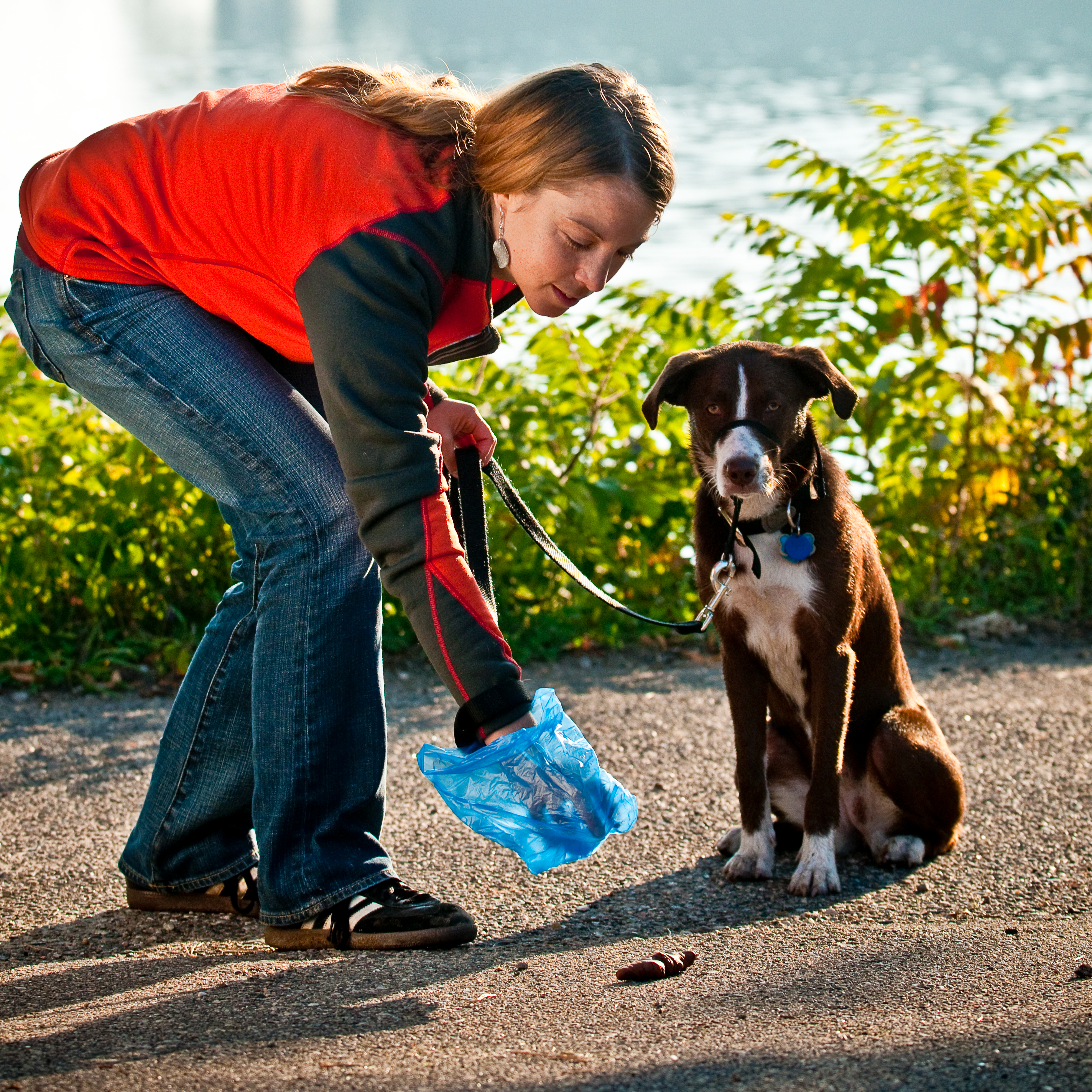
Pick up pet waste.
Pet waste stinks, but the harms of dog poo go beyond odors. Pet waste contains concentrated nutrients and bacteria that pollute local waters and threaten human health. The next time you take your furry friend for a walk, remember three tips to keep our waters clean:
1. Bring a bag.
2. Pick up pet waste right away.
3. Make sure bagged pet waste makes it into a trash can.