Westfield Park Bioswale
Quick Facts:
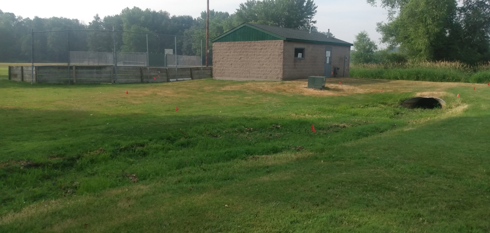
The Westfield Park Bioswale is located near the ice rink warming house in Westfield Park.
The Bioswale takes water from 8.5 acres of nearby neighborhood which drains into Lambert Creek.
Lambert Creek ultimately drains into East Vadnais Lake, a drinking water reservoir for over 450,000 people in and around the City of Saint Paul.
Funding:
The effort is funded by the City of Vadnais Heights and VLAWMO’s Landscape Level 2 grant program.
Reason for Project:
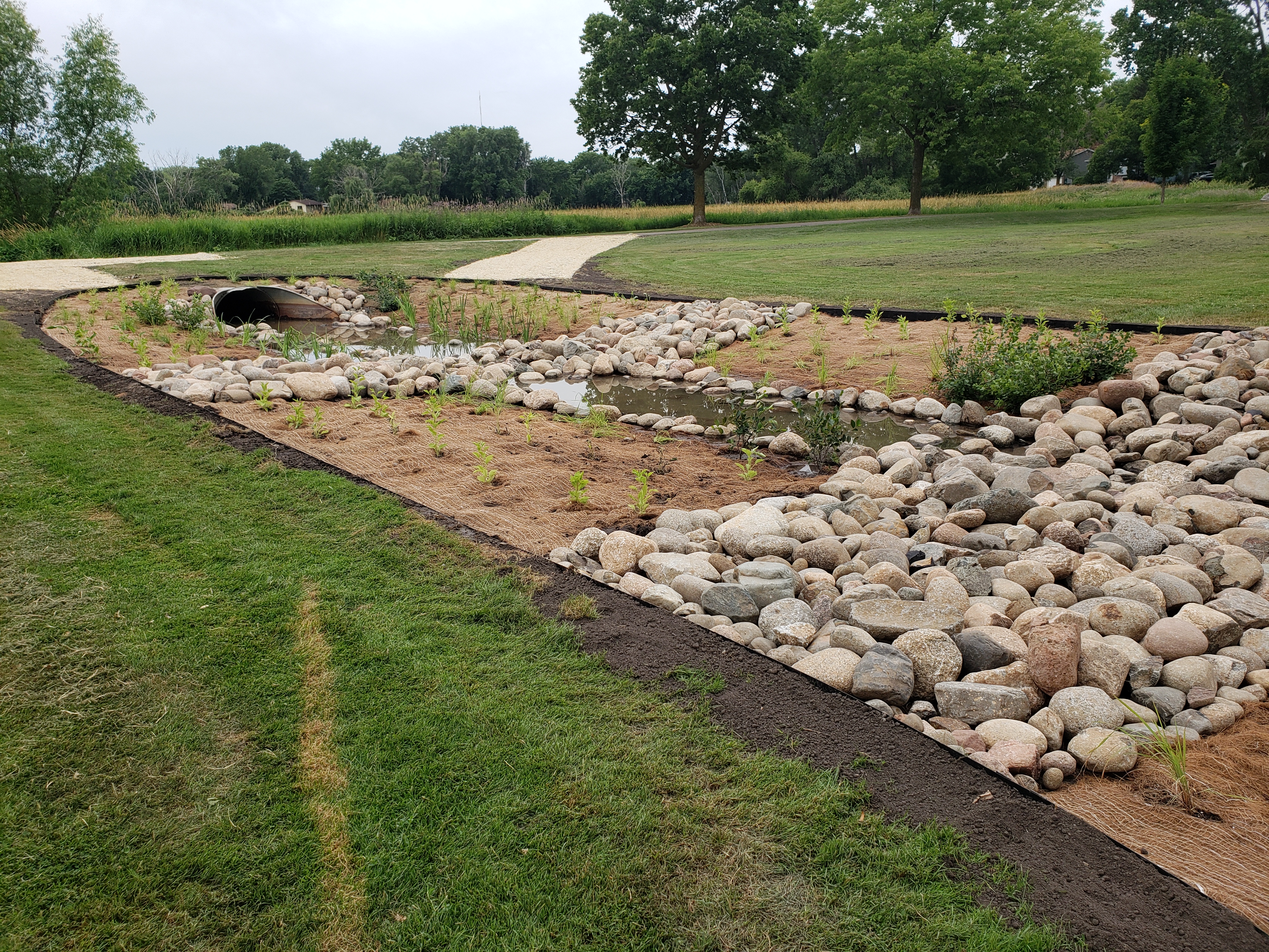
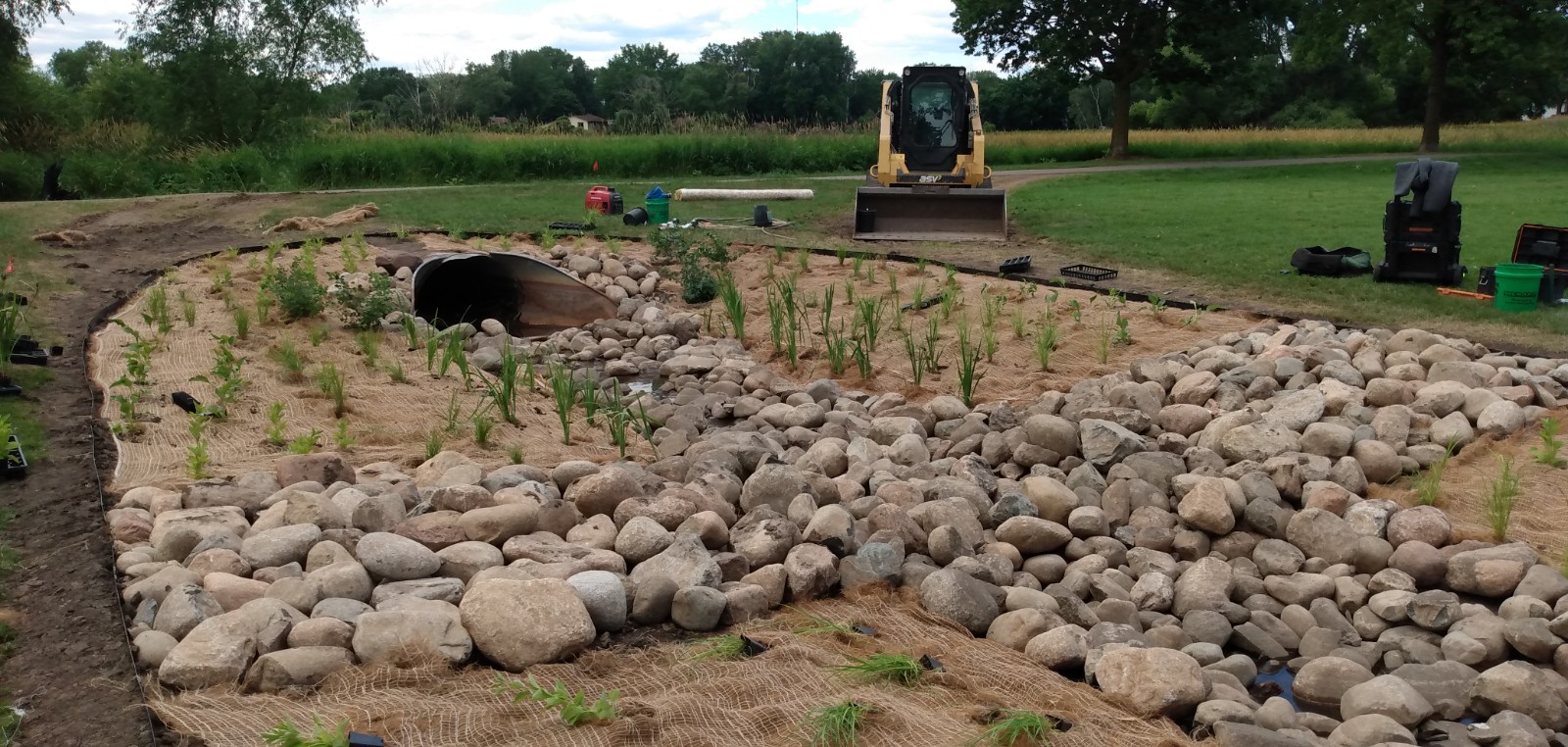
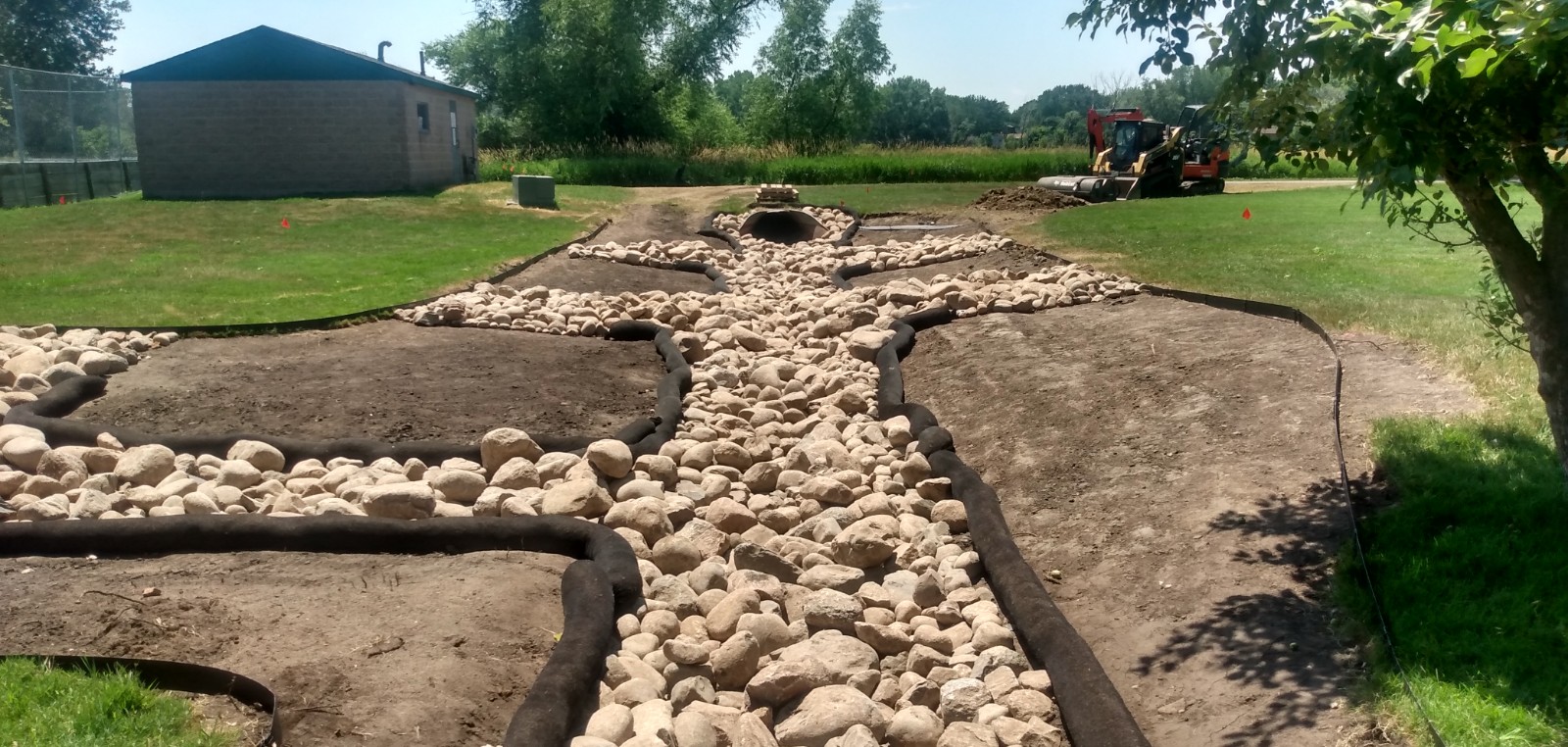
Bioswales resemble ditches in that they collect stormwater from roads, driveways, and other hard surfaces. Unlike ditches however, swales have gentler side slopes and are wider than they are deep.
The Westfield Bioswale provides stormwater rate and volume control at a location that receives a large amount of pressure in the form of runoff volume and sedimentation. By improving upland storage capacity, the Basswood wetland and downstream Lambert Creek are better protected from excess sediment and nutrient loading. Trap rock in the bioswale helps to slow and disperse runoff velocity, which reduces runoff's impact as it drains through the system. Native plants provide additional filtration for downstream waters and help hold soil in place.
Westfield Park was formerly a wetland, but was filled before current wetland protection laws went into place. The park's underlying soil can still function as wetland soil that holds water, but the added fill across the park and routing of stormwater through ditches concentrates incoming runoff.
The Westfield Bioswale is one of several green infrastructure efforts in partnership between VLAWMO and the City of Vadnais Heights. Together these efforts strive for a balance between water drainage, storage, and quality.
Construction:
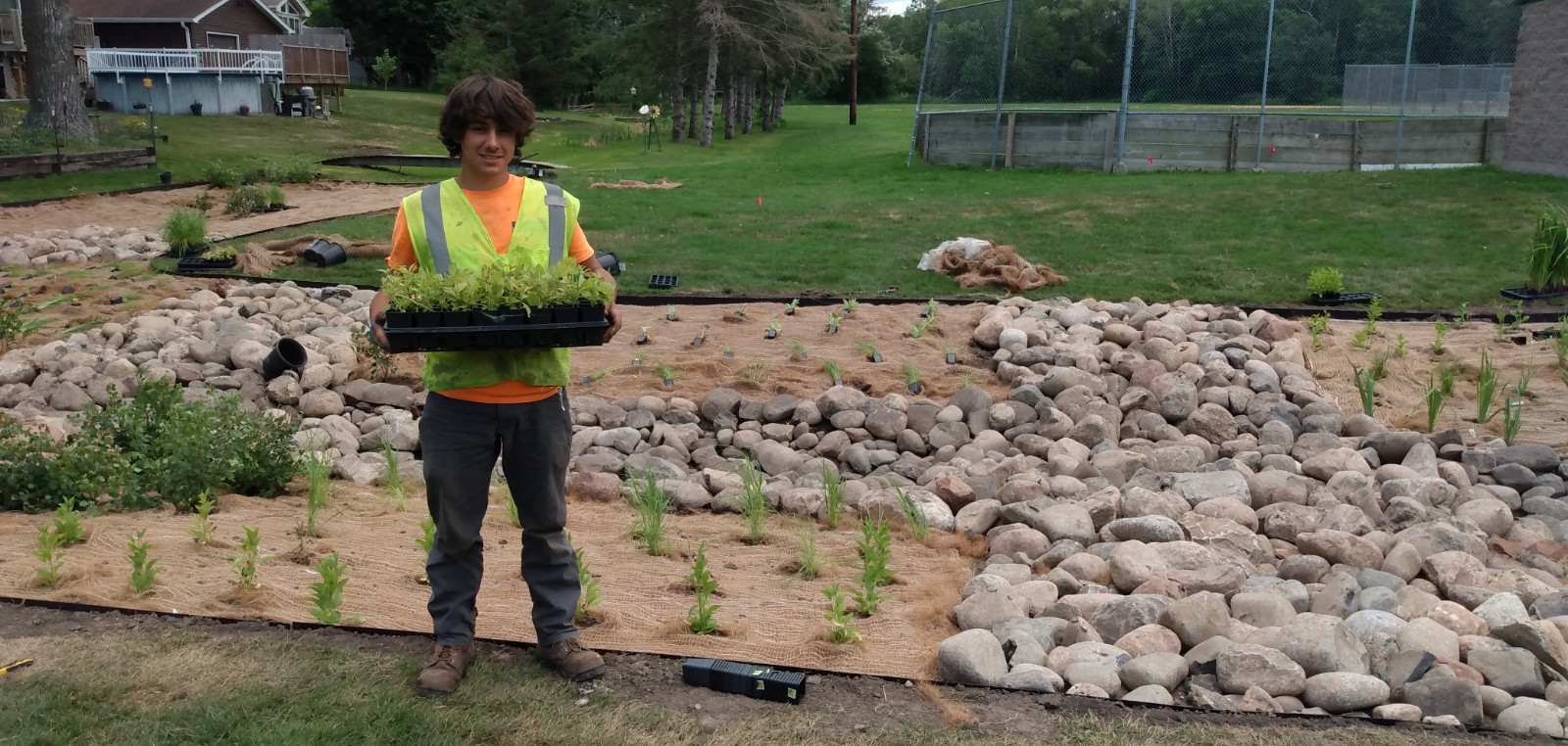
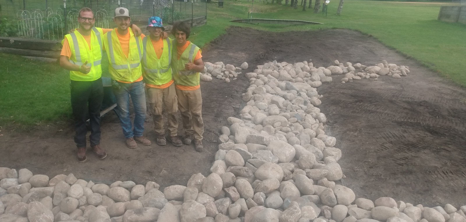
The existing sod at the bioswale area was removed and the soil was loosened and regraded to reshape how stormwater moves through the swale. The regrading emphasizes a low center basin that runs along the center of the swale. A dry creek bed and river rock check dams were then added. Lastly, over 650 native plants and erosion control blanket were installed, with specific plants that can tolerate temporary standing water placed towards the bottom of the swale.
Results:
The Bioswale is expected to reduce volume of stormwater runoff by 22% from its drainage area, which results in a 75% reduction in sedimentation and 51% reduction in phosphorus runoff. The local effort at Westfield Park is part of a larger strategy of managing water across the watershed.
Westfield Park Bioswale Education Sign

Project Image Gallery

|
|
|
|
|
|
|
Search projects
Birch Lake Aquatic Invasive Species Efforts
4th and Otter Woodland Restoration
Birch Lake Sand-Iron Stormwater Filter
Birch Lake North Shoreline Restoration
Charley Lake Channel Restoration
Deep Lake Channel Restoration
 Contact us
Phone: (651) 204-6070
Fax: (651) 204-6173
Email: office@vlawmo.org