Lambert Creek E. coli Source Study
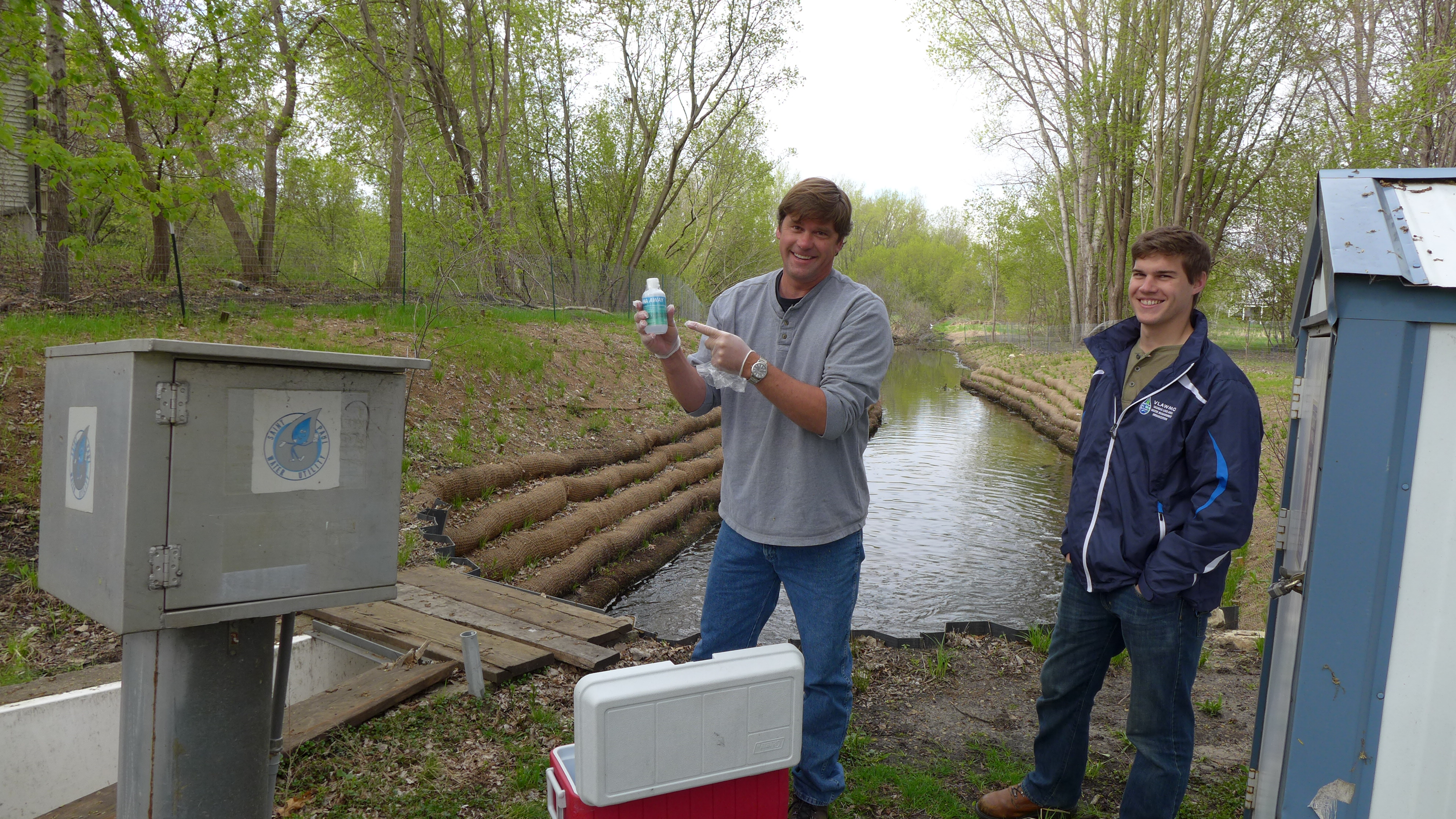
Lambert Creek is currently on the state impaired list for high levels of E. coli. The creek was monitored for E. coli at 5 sub-watershed sampling locations weekly during the summer from 2008-2012. The Vadnais Lake Area WMO is currently working with a consultant to do target monitoring and molecular sourcing (E. coli host: human, animal or avian) at these locations to both determine the source of the E. coli impairment and also determine proper best management practices (BMP's) to reduce the E. coli impairment. VLAWMO began monitoring two sub-watershed locations this summer on Lambert Creek (Oakmede and Cty Rd. F) to understand where the Lambert Creek E. coli impairment is coming from. The target monitoring will give us better idea where the hot spots for E. coli are at each location on the creek and the molecular sourcing will tell us the origin of the E. coli.
This year E. coli culture samples were taken 4 days a week for three to four weeks. We have to get samples during dry conditions so at least 72 hrs from a significant rainfall for a minimum of 12 samples at each sample site in order to get a significant data set to run the statistics on the results. Once these samples have been analyzed we will then begin the molecular sampling at each of these locations.
For the molecular sampling we will be taking 2 molecular samples twice weekly for two to three weeks at Oakmede and 3 molecular samples twice weekly for two to three weeks at Cty Rd. F. These samples will also be taken during dry conditions.
At the completion of this project we hope to have an understanding of exactly where the E. coli is coming from at these locations on the creek and also area's to incorporate BMP's to reduce the ecoli impairment to below state standards. The 3 other sub-watersheds on the creek (Whitaker, Goose and Koehler) will be addressed next summer.
What have we learned?
- History of Whitaker Pond 8-30-18.pdf
- Lambert Creek Bacteria Source ID Study 2014
- E. coli Monitoring Summary 2014

Project Image Gallery
|
Search projects
Birch Lake Aquatic Invasive Species Efforts
4th and Otter Woodland Restoration
Birch Lake Sand-Iron Stormwater Filter
Birch Lake North Shoreline Restoration
Charley Lake Channel Restoration
Deep Lake Channel Restoration
 Contact us
Phone: (651) 204-6070
Fax: (651) 204-6173
Email: office@vlawmo.org