Water monitoring season is well underway for the Vadnais Lake Area Water Management Organization (VLAWMO). Staff head out bimonthly to sample numerous water quality indicators including bacteria, chloride, Chlorophyll-A, phosphorus, total suspended solids, pH, conductivity, dissolved oxygen, and temperature. Occasionally, they conduct storm sampling. This data helps VLAWMO and partners get a clearer picture of the state of waterbodies throughout the watershed. You can learn more about specific sampling parameters on the water quality monitoring webpage.
VLAWMO’s lake monitoring program began in 1997. Today, staff regularly collect samples from 15 waterbodies: Amelia Lake, Birch Lake, Black Lake, Charley Lake, Deep Lake, Gem Lake, Gilfillan Lake, Goose Lake East, Goose Lake West, Pleasant Lake, Sucker Lake, Tamarack Lake, East & West Vadnais Lake, and Wilkinson Lake. Six areas along Lambert Creek are also sampled.
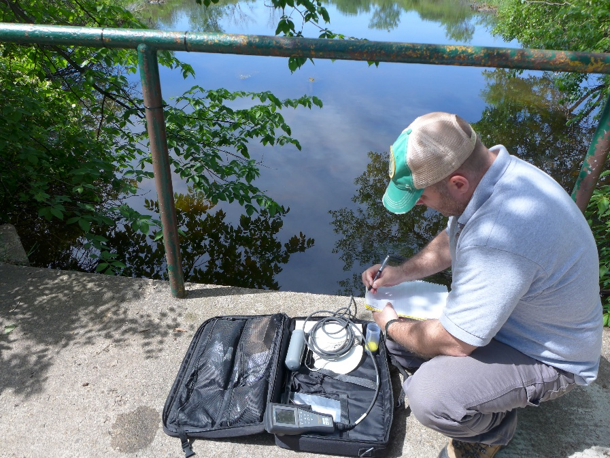
Above: At some sites, staff utilize a YSI device to gather water quality metrics including dissolved oxygen (DO), pH, temperature, and conductivity.
These monitoring outings – which are the lake or stream equivalent of health checkups for humans – happen every other week from May through September. They allow staff to better understand the waterbodies VLAWMO works to protect. Staff log key metrics about lakes and streams, filling sampling bottles along the way to send for further testing in a lab. VLAWMO’s work is anchored by scientific best practices, and the robust data gathered by staff is critically important to the organization.
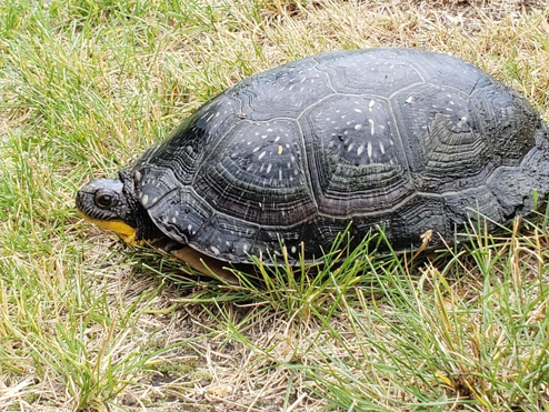
Above: Staff spotted a Blanding's Turtle while monitoring in June 2026. These large turtles are a threatened species in Minnesota.
Beyond the value provided by numerical data, water monitoring outings help form watershed connections. Staff notice loons nesting, osprey, Great Blue Herons, turtles, and deer. Staff take note of aquatic plants. Staff witness stormwater infrastructure in action.
The VLAWMO watershed is relatively compact, encompassing just over 24 square miles. Nevertheless, the watershed boasts a striking diversity of waterbodies. Many of VLAWMO’s waters have no public access, meaning private homeowners surround them. Out in the field, staff see clues of lives built around these lakes: seating and docks, native shoreline plantings and rain gardens, boats, and more. These visual snippets, spotted while sealing bottles or trekking down to the water’s edge, remind staff of the “why” behind VLAWMO’s work.
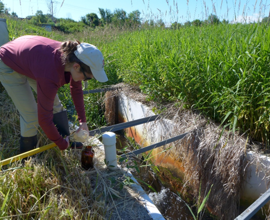
Above: staff regularly conduct monitoring at six sites along Lambert Creek.
In early July, half of the water monitoring season stretches ahead. The water quality monitoring program is essential to VLAWMO’s work. It shapes water quality projects and guides local water policies and management. There is always more sampling to do and more data to record. This work continues to provide insight into the health of waterbodies—both now and throughout the years.
Learn more about the water quality monitoring program.
Discover what creek monitoring entails in this 1-minute video.