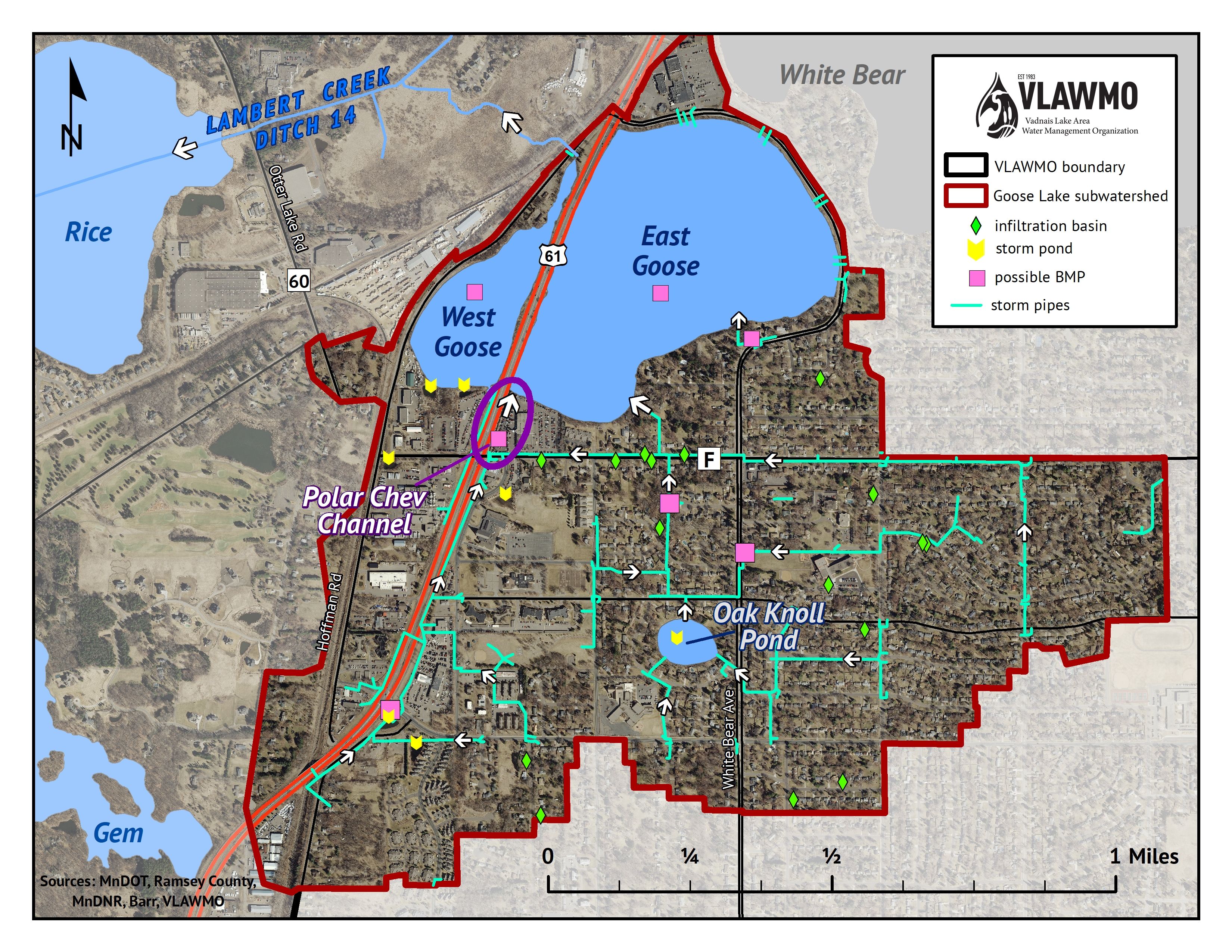
East Goose Lake receives surface water from the surrounding subwatershed as well as Oak Knoll Pond/Wood Lake. East Goose connects to West Goose through two culverts beneath Highway 61, which divided the lake into two basins in the 1960's. Like many shallow lakes in the Twin Cities, Goose Lake was historically a dynamic waterbody that switched between a wetland and an open water lake depending on changing water levels. West Goose outlets into the headwaters of Lambert Creek, which flows into East Vadnais Lake, the surface water reservoir for the Saint Paul Regional Water Services (SPRWS).
West Goose Lake is classified by the Minnesota DNR as a wetland, but is commonly referred to as a lake. Oak Knoll Pond, also known as Wood Lake, is located south of East Goose Lake near White Bear Avenue. Records and aerial imagery indicate that it is a natural pond that has transitioned from agriculture to suburban land use.
Surface Area
145 acres
Average Depth
4-6 ft
Maximum Depth
6-8 ft
Catchment Area
841 acres
Location
White Bear Lake